Why Germany is facing extreme winter weather this month
A mix of icy polar air in northern Germany and very mild spring air in the south will result in rare winter weather conditions. Here's what's forecast and why.
What's happening?
Forecasters are predicting rare and difficult weather conditions in Germany starting this weekend.
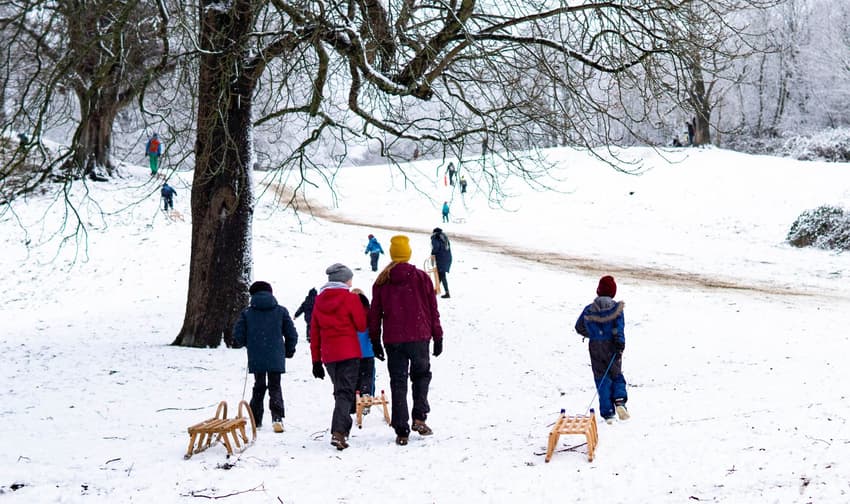
Large amounts of snowfall is expected in the northern half of the country while it will rain in the south.
Over the weekend, temperatures will hover around freezing in the north and northeast during the day, dipping to -7C at night. In the south and southwest, the mercury could reach a very respectable 13C.
In the Berlin-Brandenburg region, 5 to 20 centimetres of snow is possible from Sunday to Monday - and even up to 40 cm in some parts of the region.
And in the parts of Germany where the cold and warm air meet there's expected to be a lot of wind, which means that full-blown snowstorms may happen at an icy -5C.
It is still unclear whether the area of snowfall will spread between North Rhine-Westphalia and eastern Germany or from Münsterland via the Hanover area to Saxony.
Following the snow, at least a week of freezing permafrost on the ground is expected.
READ ALSO: Weird weather - temperatures between -7C and up to 20C expected in Germany at weekend
So why is this happening now?
According to experts, the conditions for this burst of cold air developed at the beginning of the year because there's an unusually unstable polar vortex at the moment.
In January, the polar vortex - a huge low-pressure area that circulates in the stratosphere far above the Arctic in winter - collapsed.
As a result, the jet stream - a band of strong winds in the atmosphere - also became unstable.
It began to lurch, allowing cold air to penetrate far to the south. A stable polar vortex, on the other hand, normally ensures a strong jet stream that holds the cold air together over the Arctic, thus clearing the way for warmer air masses from the Atlantic to reach Europe.
The tweet by the German Weather Service (DWD) below shows the split in weather conditions across Germany on Friday.
Am heutigen Freitagvormittag im Norden und Osten noch leichter Frost und gebietsweise Glätte, sowie regional Nebel. An der nordfrisischen Küste starke Böen aus Ost. In der West- und Südhälfte deutlich milder und gebietsweise fällt Regen. /V pic.twitter.com/mVJ2Q3Alvz
— DWD (@DWD_presse) February 5, 2021
Climate researcher Marlene Kretschmer, of the University of Reading in the UK, told the Berlin Tagesspiegel newspaper that as far as can be judged at present, the cold air is related to the state of the polar vortex.
"We know that the probabilities for such weather situations increase very strongly when the polar vortex is weak," Kretschmer said.
After the collapse of the polar vortex in early January, this kind of event occurred twice more. "After a short recovery, the vortex became weak again - these weak phases favour weather situations like we are currently seeing," she said.
The vortex split, causing more unstable weather which some meteorologists and scientists expect to happen again. Kretschmer currently expects a shift of the vortex, but the effects on the weather are similar.
The collapse of the polar vortex is accompanied by a sudden warming in the stratosphere at an altitude of 10 to 50 kilometres - a so-called major warming characterised by easterly winds at high altitudes. This increases the likelihood of icy polar air from the Arctic to the south.
These kinds of situations are observed about seven times in 10 years, and in extreme cases, such as in 2013, Germany can experience severe frost, even permafrost, into April.
But the consequences of the event could also hit Scandinavia and regions east of it harder.
In Western Europe, there are many other drivers of the weather. "In Germany, the effect of weak polar vortex phases varies greatly from event to event," Kretschmer said.
Effects can last up to two months
Extreme events in the stratosphere are relatively short-lived, but they can affect our weather for several weeks, say forecasters.
Kretschmer is also concerned with the question of whether global warming could contribute to an accumulation of extreme winters. To what extent climate change plays a role in the current event is difficult to judge, she said.
Some forecasters now believe the polar vortex will not recover this winter, which would allow cold waves to continue into spring.
Kretschmer, however, thinks it is too early to make these statements. At the moment, it's unclear how long the extreme weather will continue and affect Germany.
Meanwhile, some weather experts have said there is the potential for a repeat of Europe's catastrophic winter of 1978/79, but say it's too early to jump to conclusions.
Comments
See Also
What's happening?
Forecasters are predicting rare and difficult weather conditions in Germany starting this weekend.
Large amounts of snowfall is expected in the northern half of the country while it will rain in the south.
Over the weekend, temperatures will hover around freezing in the north and northeast during the day, dipping to -7C at night. In the south and southwest, the mercury could reach a very respectable 13C.
In the Berlin-Brandenburg region, 5 to 20 centimetres of snow is possible from Sunday to Monday - and even up to 40 cm in some parts of the region.
And in the parts of Germany where the cold and warm air meet there's expected to be a lot of wind, which means that full-blown snowstorms may happen at an icy -5C.
It is still unclear whether the area of snowfall will spread between North Rhine-Westphalia and eastern Germany or from Münsterland via the Hanover area to Saxony.
Following the snow, at least a week of freezing permafrost on the ground is expected.
READ ALSO: Weird weather - temperatures between -7C and up to 20C expected in Germany at weekend
So why is this happening now?
According to experts, the conditions for this burst of cold air developed at the beginning of the year because there's an unusually unstable polar vortex at the moment.
In January, the polar vortex - a huge low-pressure area that circulates in the stratosphere far above the Arctic in winter - collapsed.
As a result, the jet stream - a band of strong winds in the atmosphere - also became unstable.
It began to lurch, allowing cold air to penetrate far to the south. A stable polar vortex, on the other hand, normally ensures a strong jet stream that holds the cold air together over the Arctic, thus clearing the way for warmer air masses from the Atlantic to reach Europe.
The tweet by the German Weather Service (DWD) below shows the split in weather conditions across Germany on Friday.
Am heutigen Freitagvormittag im Norden und Osten noch leichter Frost und gebietsweise Glätte, sowie regional Nebel. An der nordfrisischen Küste starke Böen aus Ost. In der West- und Südhälfte deutlich milder und gebietsweise fällt Regen. /V pic.twitter.com/mVJ2Q3Alvz
— DWD (@DWD_presse) February 5, 2021
Climate researcher Marlene Kretschmer, of the University of Reading in the UK, told the Berlin Tagesspiegel newspaper that as far as can be judged at present, the cold air is related to the state of the polar vortex.
"We know that the probabilities for such weather situations increase very strongly when the polar vortex is weak," Kretschmer said.
After the collapse of the polar vortex in early January, this kind of event occurred twice more. "After a short recovery, the vortex became weak again - these weak phases favour weather situations like we are currently seeing," she said.
The vortex split, causing more unstable weather which some meteorologists and scientists expect to happen again. Kretschmer currently expects a shift of the vortex, but the effects on the weather are similar.
The collapse of the polar vortex is accompanied by a sudden warming in the stratosphere at an altitude of 10 to 50 kilometres - a so-called major warming characterised by easterly winds at high altitudes. This increases the likelihood of icy polar air from the Arctic to the south.
These kinds of situations are observed about seven times in 10 years, and in extreme cases, such as in 2013, Germany can experience severe frost, even permafrost, into April.
But the consequences of the event could also hit Scandinavia and regions east of it harder.
In Western Europe, there are many other drivers of the weather. "In Germany, the effect of weak polar vortex phases varies greatly from event to event," Kretschmer said.
Effects can last up to two months
Extreme events in the stratosphere are relatively short-lived, but they can affect our weather for several weeks, say forecasters.
Kretschmer is also concerned with the question of whether global warming could contribute to an accumulation of extreme winters. To what extent climate change plays a role in the current event is difficult to judge, she said.
Some forecasters now believe the polar vortex will not recover this winter, which would allow cold waves to continue into spring.
Kretschmer, however, thinks it is too early to make these statements. At the moment, it's unclear how long the extreme weather will continue and affect Germany.
Meanwhile, some weather experts have said there is the potential for a repeat of Europe's catastrophic winter of 1978/79, but say it's too early to jump to conclusions.
Join the conversation in our comments section below. Share your own views and experience and if you have a question or suggestion for our journalists then email us at [email protected].
Please keep comments civil, constructive and on topic – and make sure to read our terms of use before getting involved.
Please log in here to leave a comment.