
Brandenburg, Berlin, and parts of Saxony can expect severe thunderstorms on Monday afternoon.
According to the German Weather Service (DWD), heavy rainfall will move northward, over the Erzgebirge from the Czech Republic. There is a risk of extreme rainfall of up to 100 litres per square metre in 12 hours in some regions.
The northeast of Mecklenburg-Vorpommern is particularly at risk, where heavy rains could continue until Tuesday afternoon.
As of 10am on Monday morning, the DWD showed level three severe weather warnings along Germany's north-eastern border including around Berlin.
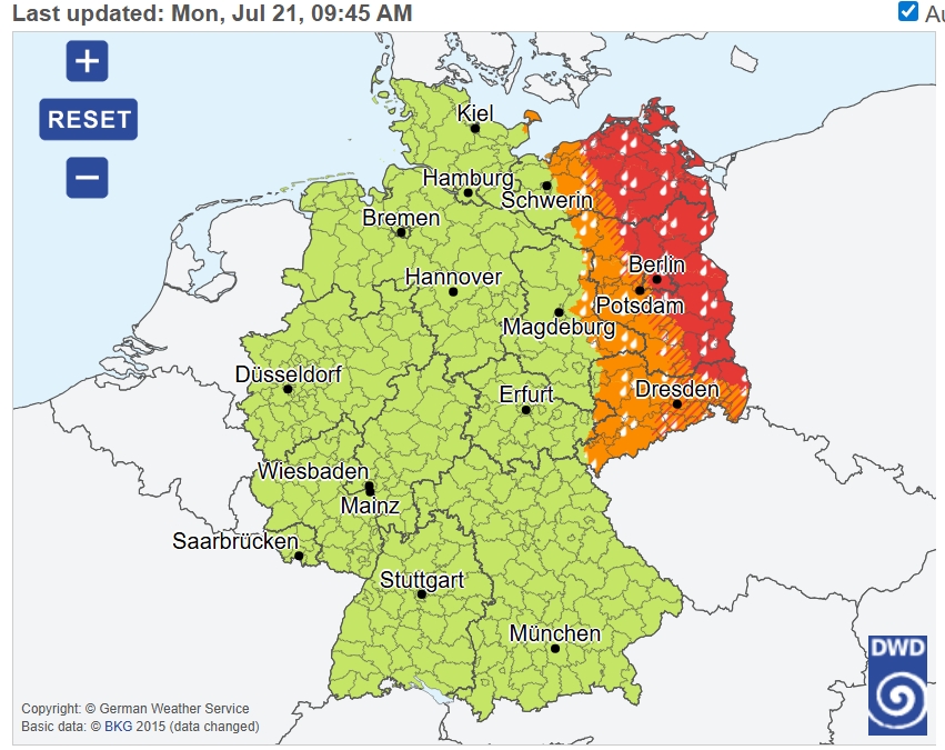
Rain in the east will be accompanied by thunderstorms, with the possibility of winds up to 80 kilometres per hour and hail.
Germany’s Tagesschau is also warning of hurricane-force gusts (orkanartige Böen), hail, and a risk of flooding in Brandenburg, Saxony, and Bavaria, especially in the afternoon and evening.
READ ALSO: Should you get Germany's extreme weather emergency warning app?
Thunderstorms are also expected in the west and south of Germany in the early afternoon, spreading to the centre of the country by evening.
Forecasts for north-western Germany are relatively benign by comparison. Even here, however, after a temperate start to the day, the risk of thunderstorms will increase significantly during the evening, accompanied by winds and rain.
The band of thunderstorms is expected to gradually move eastward during the evening.
Recommended precautions to take during during a thunderstorm:
Avoid staying outdoors during thunderstorms.
Secure loose objects on balconies and in gardens.
Avoid underpasses and basements in case of flooding.
Check regional warning apps or the DWD for regular updates.
Comments