IN PHOTOS: Powerful May storm 'Eugen' strikes western Germany

In the west and north of Germany, gusts of up to 140 km/h were measured around the country as the storm front dubbed 'Eugen' struck.
The German Weather Service (DWD) has issued a storm warning, of either the highest level of red or second level of orange, around the country.
Severe gales up to 100 km/h struck lowland areas. On exposed mountain peaks, hurricane-like gusts ranging between 105 to 138 km/h were recorded.
In the west and northwest, there have also been thunderstorms with sleet or small hail, and winds of up to 80km per hour.
This map from DWD shows the German regions which were most affected by the storm, which was set to pass by Wednesday morning.
#Sturmtief #EUGEN beschert uns einen stürmischen Tag!
Bis ins Flachland stürmische Böen und Sturmböen (Beaufort 8-9). Bei kräftigen #Schauern und einzelnen #Gewittern auch schwere Sturmböen (Beaufort 10). Höchste Wahrscheinlichkeit dazu im rot markierten Bereich. /V pic.twitter.com/Gy3GR5vZHR
— DWD (@DWD_presse) May 4, 2021
DWD also broke down the cities which recorded the highest wind speeds on Tuesday.
#Sturm #EUGEN fegt über Deutschland.
Hier eine Auswahl bisher gemessener Böen:
138 km/h Brocken
110 km/h Wasserkuppe
108 km/h Haaren
100 km/h Aachen-Orsbach
96 km/h Bremen
95 km/h Werl
95 km/h Arnsberg-Müschede
91 km/h Lüdenscheid
89 km/h Eisenach
89 km/h Chemnitz /V
— DWD (@DWD_presse) May 4, 2021
Here’s a look in photos of the impact the storm has had around the country.
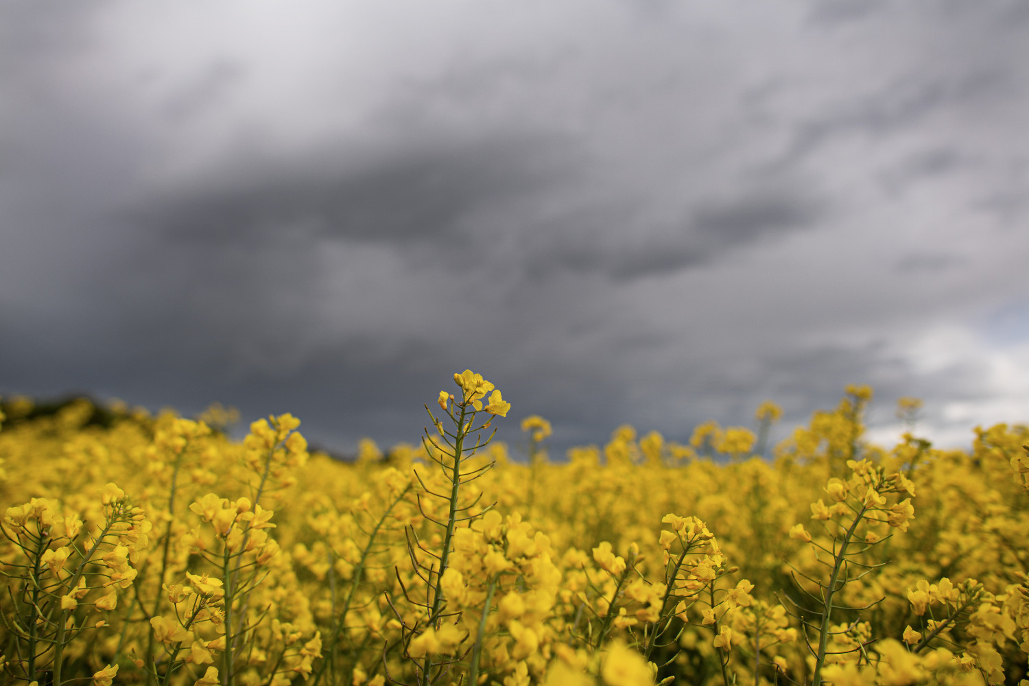
Dark clouds drifted over a rapeseed field in Worringen, North Rhine-Westphalia, where there were winds of up to 100 km per hour. Photo below: picture alliance/dpa | Federico Gambarini
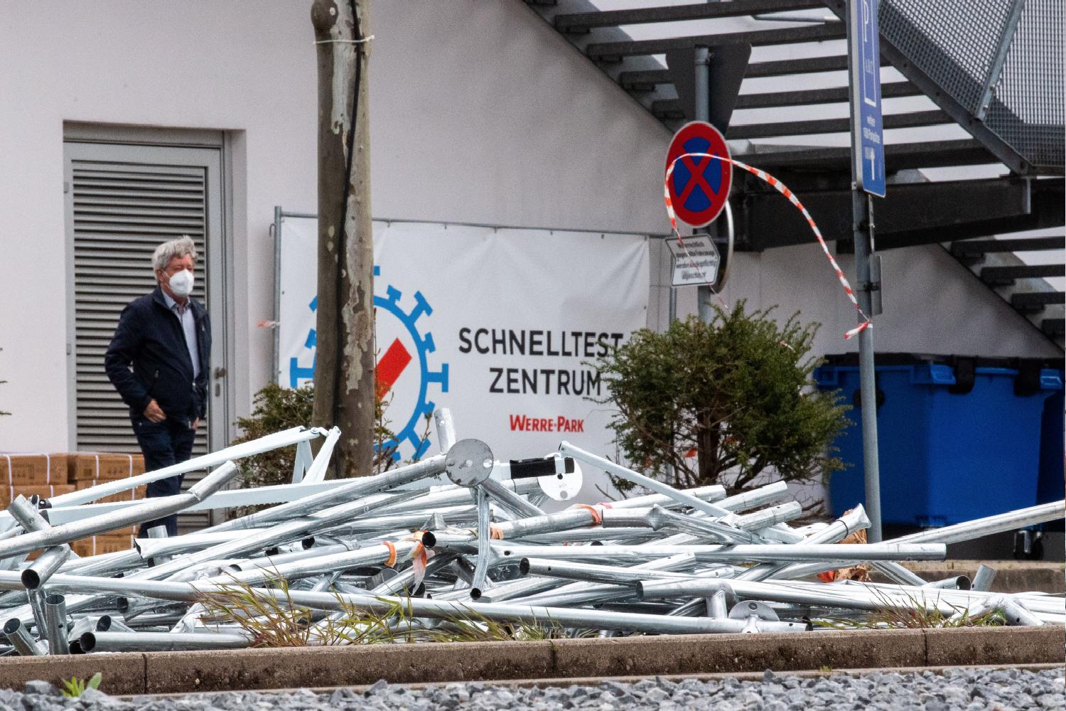
The poles from a destroyed coronavirus test centre were strewn in a car park in Bad Oeynhausen, North Rhine-Westphalia. Photo: picture alliance/dpa | Lino Mirgeler.
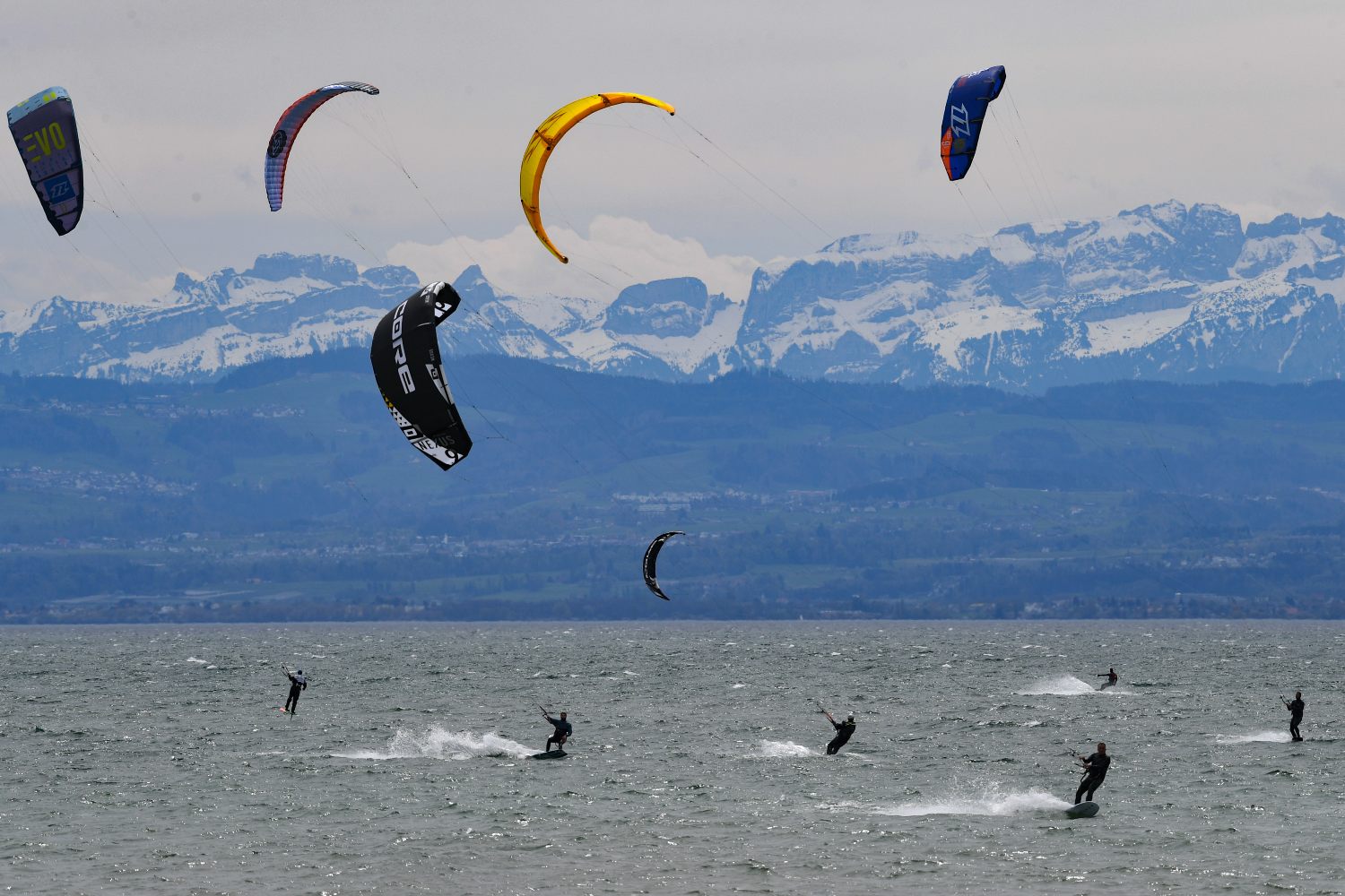
 But the storm was not such a bad thing for the many kite surfers who took advantage of the strong winds at the Boddensee, in Friedrichshafen, Baden-Württemberg. Photo: picture alliance/dpa | Felix Kästle
'Sturm' was the top trending tag on Twitter as many people posted their photos and videos of the ominously dark skies with fast moving clouds.
Fast moving clouds from #StormEugen today in Hildesheim #Germany #Eugen #storm #clouds #Sturm #unwetter #StormHour pic.twitter.com/3RQwPUUOBL
— Mark Robert Davey (@kramtreboryevad) May 4, 2021
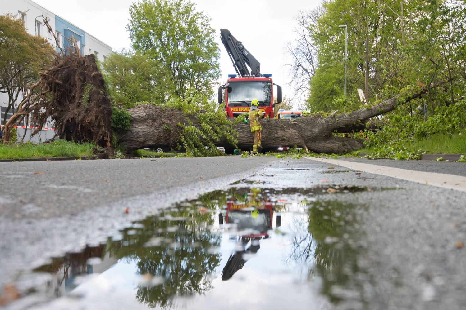
The winds were so strong that they brought down several trees, such as this one in Hanover. Photo: picture alliance/dpa | Julian Stratenschulte
 In Berlin, which was not as heavily affected, cherry blossom trees looked extra dramatic against the grey sky. They alluded to the warm weather to follow everywhere in Germany over the next few days, bringing temperatures of up to 28C by Sunday. Photo: picture alliance/dpa | Jörg Carstensen

Comments
See Also
The German Weather Service (DWD) has issued a storm warning, of either the highest level of red or second level of orange, around the country.
Severe gales up to 100 km/h struck lowland areas. On exposed mountain peaks, hurricane-like gusts ranging between 105 to 138 km/h were recorded.
In the west and northwest, there have also been thunderstorms with sleet or small hail, and winds of up to 80km per hour.
This map from DWD shows the German regions which were most affected by the storm, which was set to pass by Wednesday morning.
#Sturmtief #EUGEN beschert uns einen stürmischen Tag!
— DWD (@DWD_presse) May 4, 2021
Bis ins Flachland stürmische Böen und Sturmböen (Beaufort 8-9). Bei kräftigen #Schauern und einzelnen #Gewittern auch schwere Sturmböen (Beaufort 10). Höchste Wahrscheinlichkeit dazu im rot markierten Bereich. /V pic.twitter.com/Gy3GR5vZHR
DWD also broke down the cities which recorded the highest wind speeds on Tuesday.
#Sturm #EUGEN fegt über Deutschland.
— DWD (@DWD_presse) May 4, 2021
Hier eine Auswahl bisher gemessener Böen:
138 km/h Brocken
110 km/h Wasserkuppe
108 km/h Haaren
100 km/h Aachen-Orsbach
96 km/h Bremen
95 km/h Werl
95 km/h Arnsberg-Müschede
91 km/h Lüdenscheid
89 km/h Eisenach
89 km/h Chemnitz /V
Here’s a look in photos of the impact the storm has had around the country.
Dark clouds drifted over a rapeseed field in Worringen, North Rhine-Westphalia, where there were winds of up to 100 km per hour. Photo below: picture alliance/dpa | Federico Gambarini
The poles from a destroyed coronavirus test centre were strewn in a car park in Bad Oeynhausen, North Rhine-Westphalia. Photo: picture alliance/dpa | Lino Mirgeler.
But the storm was not such a bad thing for the many kite surfers who took advantage of the strong winds at the Boddensee, in Friedrichshafen, Baden-Württemberg. Photo: picture alliance/dpa | Felix Kästle
'Sturm' was the top trending tag on Twitter as many people posted their photos and videos of the ominously dark skies with fast moving clouds.
Fast moving clouds from #StormEugen today in Hildesheim #Germany #Eugen #storm #clouds #Sturm #unwetter #StormHour pic.twitter.com/3RQwPUUOBL
— Mark Robert Davey (@kramtreboryevad) May 4, 2021
The winds were so strong that they brought down several trees, such as this one in Hanover. Photo: picture alliance/dpa | Julian Stratenschulte
In Berlin, which was not as heavily affected, cherry blossom trees looked extra dramatic against the grey sky. They alluded to the warm weather to follow everywhere in Germany over the next few days, bringing temperatures of up to 28C by Sunday. Photo: picture alliance/dpa | Jörg Carstensen
Join the conversation in our comments section below. Share your own views and experience and if you have a question or suggestion for our journalists then email us at [email protected].
Please keep comments civil, constructive and on topic – and make sure to read our terms of use before getting involved.
Please log in here to leave a comment.