
The DWD’s warning sounds ominous. “A torrent of cool sea air is streaming into Germany behind a cold deep pressure front,” it says in its weather report.
Throughout Monday this unstable air could lead to heavy rain, hail, and stormy gusts of wind in the eastern regions of the country.
“We can’t rule out hail of up to 2 cm in diameter, torrential rain and gusts of wind, particularly on the Polish border,” the warning continues.
The situation is expected to stabilize towards the evening.
In the north and east of the country temperatures are not expected to rise above 24 degrees Celsius.
The south of Germany is in for a much hotter day, with temperatures rising to 32C in some spots.
Thunder, lightening and short deluges can be expected in the Alpine region of Bavarian later in the afternoon.
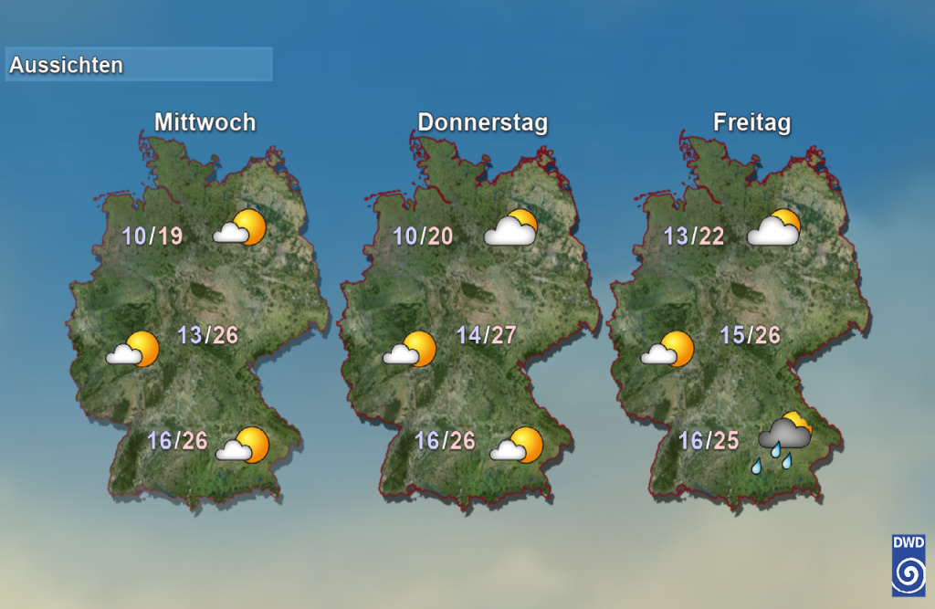
Graphic showing the weather around Germany, Wednesday-Friday. Credit: DWD
Later in the week the situation is set to calm down across much of the country, with pleasant summer temperatures in the mid-20s predicted across much of central and southern Germany.
In the north, highs of 20-22C will be the norm over the coming days.
Comments