Germany braces for violent storms and extreme winds
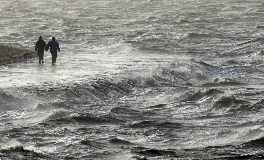
Storm Sabine is forecast to hit Germany at the end of the weekend bringing with it high winds and rain.
On Sunday forecasters predict heavy showers, gale-force winds and thunderstorms. There might also be some hailstones and localized flooding.
In a statement, the German Weather Service (DWD) said the weekend would be fairly calm from a meteorological point of view, but "from Sunday onwards the tone will change significantly, as a nationwide, partly severe storm situation is likely".
Forecasters said the strong gusts will be felt in the northwest of Germany as early as Sunday morning, particularly in areas at the North Sea coast.
The storm will then spread to the north and centre of the country. And on Sunday night, the south of Germany will also be affected.
DWD posted this graphic which shows where the strongest winds are expected (areas in red on the map).
#Sturm #SABINE: erste graphische Einschätzung der Sturmsituation ab Sonntag. In den rot markierten Bereichen sind schwere Sturmböen um 100 km/h wahrscheinlich, einzelne orkanartige Böen oder Orkanböen ebenfalls. Besonders in Gewitternähe muss darauf geachtet werden. /V pic.twitter.com/oOHHUMPLvU
— DWD (@DWD_presse) February 7, 2020
According to forecasters, the wind will continue to increase and heavy gusts are likely in some areas.
"With a cold front moving simultaneously from northwest to southeast, gale-force gusts of over 105 km/h and hurricane-speed gusts are also possible at times," said the weather service.
Some weather experts predicted wind speeds of more than 120km/h.
 Rescue workers at the scene of a fallen tree in Stuttgart on Tuesday. Photo: DPA
Meanwhile, the storm will likely continue throughout Monday until the early hours of Tuesday.
DWD tweeted a warning on Thursday to say that the storm coming from the Norway area was due to arrive in Germany from Sunday.
Achtung #schwerer #Sturm ab Sonntag!
Das #Sturmfeld eines #Orkantiefs vor der Küste Norwegens erfasst ab Sonntag ganz #Deutschland mit #Höhepunkt in der #Nacht zum #Montag! Die Grafiken zeigen die Details!
Aller Voraussicht nach wird das #Orkantief den Namen #SABINE erhalten. /V pic.twitter.com/JDtk773c06
— DWD (@DWD_presse) February 6, 2020
The weather will likely cause disruption to public transport and commuters are warned to allow more time to get to work on Monday.
Rail operator Deutsche Bahn said it was ready for any extreme weather and preparations would "naturally be in full swing".
"Technicians and staff are in stand-by mode so that in the event of a disruption, train traffic can resume as quickly as possible," the spokeswoman said.
However, meteorologist Bernd Hussing, based in Essen, said it was hard to predict the severity of the storm and winds.
"How strong it will be is still a bit uncertain," he told German newspaper, RP Online.
It came after torrential rain mixed with strong winds caused widespread disruption in southern and western Germany earlier this week.
READ ALSO: Fact check - is winter actually coming to Germany this year?
Comments
See Also
On Sunday forecasters predict heavy showers, gale-force winds and thunderstorms. There might also be some hailstones and localized flooding.
In a statement, the German Weather Service (DWD) said the weekend would be fairly calm from a meteorological point of view, but "from Sunday onwards the tone will change significantly, as a nationwide, partly severe storm situation is likely".
Forecasters said the strong gusts will be felt in the northwest of Germany as early as Sunday morning, particularly in areas at the North Sea coast.
The storm will then spread to the north and centre of the country. And on Sunday night, the south of Germany will also be affected.
DWD posted this graphic which shows where the strongest winds are expected (areas in red on the map).
#Sturm #SABINE: erste graphische Einschätzung der Sturmsituation ab Sonntag. In den rot markierten Bereichen sind schwere Sturmböen um 100 km/h wahrscheinlich, einzelne orkanartige Böen oder Orkanböen ebenfalls. Besonders in Gewitternähe muss darauf geachtet werden. /V pic.twitter.com/oOHHUMPLvU
— DWD (@DWD_presse) February 7, 2020
According to forecasters, the wind will continue to increase and heavy gusts are likely in some areas.
"With a cold front moving simultaneously from northwest to southeast, gale-force gusts of over 105 km/h and hurricane-speed gusts are also possible at times," said the weather service.
Some weather experts predicted wind speeds of more than 120km/h.
Rescue workers at the scene of a fallen tree in Stuttgart on Tuesday. Photo: DPA
Meanwhile, the storm will likely continue throughout Monday until the early hours of Tuesday.
DWD tweeted a warning on Thursday to say that the storm coming from the Norway area was due to arrive in Germany from Sunday.
Achtung #schwerer #Sturm ab Sonntag!
— DWD (@DWD_presse) February 6, 2020
Das #Sturmfeld eines #Orkantiefs vor der Küste Norwegens erfasst ab Sonntag ganz #Deutschland mit #Höhepunkt in der #Nacht zum #Montag! Die Grafiken zeigen die Details!
Aller Voraussicht nach wird das #Orkantief den Namen #SABINE erhalten. /V pic.twitter.com/JDtk773c06
The weather will likely cause disruption to public transport and commuters are warned to allow more time to get to work on Monday.
Rail operator Deutsche Bahn said it was ready for any extreme weather and preparations would "naturally be in full swing".
However, meteorologist Bernd Hussing, based in Essen, said it was hard to predict the severity of the storm and winds.
"How strong it will be is still a bit uncertain," he told German newspaper, RP Online.
It came after torrential rain mixed with strong winds caused widespread disruption in southern and western Germany earlier this week.
READ ALSO: Fact check - is winter actually coming to Germany this year?
Join the conversation in our comments section below. Share your own views and experience and if you have a question or suggestion for our journalists then email us at [email protected].
Please keep comments civil, constructive and on topic – and make sure to read our terms of use before getting involved.
Please log in here to leave a comment.